The City of Florence is closely monitoring the tropical system expected to become Tropical Storm Imelda.
Our crews are taking precautionary measures and preparing for potential impacts should they occur.
Although the storm’s path remains uncertain, these systems can shift quickly and without warning. It’s always better to be prepared than unprepared.
We encourage all residents to stay tuned to official sources for accurate and timely information and begin storm preparations now. The safety and well-being of our community members remains our top priority.
Additional information will be provided as it becomes available.
To view additional weather-ready resources, click here: https://mailchi.mp/3e8c4b1a7281/weather-ready-resources
Sanitation Information:
City of Florence Sanitation crews plan to operate as normal as long as weather conditions allow. Please continue to bring your roll carts and bins to the curb. An official announcement will be made through our social media channels, website, and AskCy if there are any updates to the schedule. To be notified via text, please text “Hey Cy” to (855) 964-3929 to sign up for City of Florence text alerts.
Florence County Emergency Management September 28 Morning Update:
Current status:
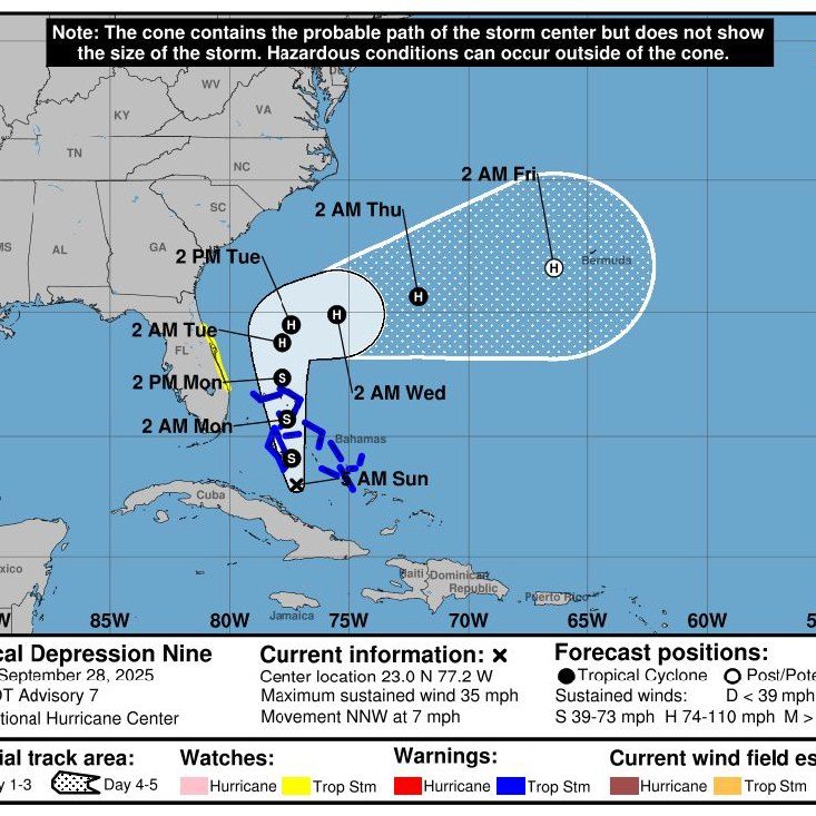
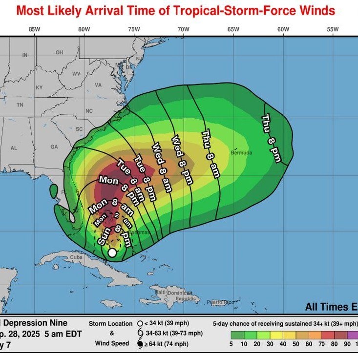
- Located about 700 miles south-southeast of the South Carolina coast
- Winds at 35 mph, moving north-northwest at 7 mph
- Expected to cross the Bahamas today and approach the Southeast U.S. coast early this week
- Forecast to become a Tropical Storm later today and a Hurricane by Tuesday
- Confidence is increasing that it will turn east before reaching the South Carolina coastline, lowering the wind threat for inland areas like Florence County
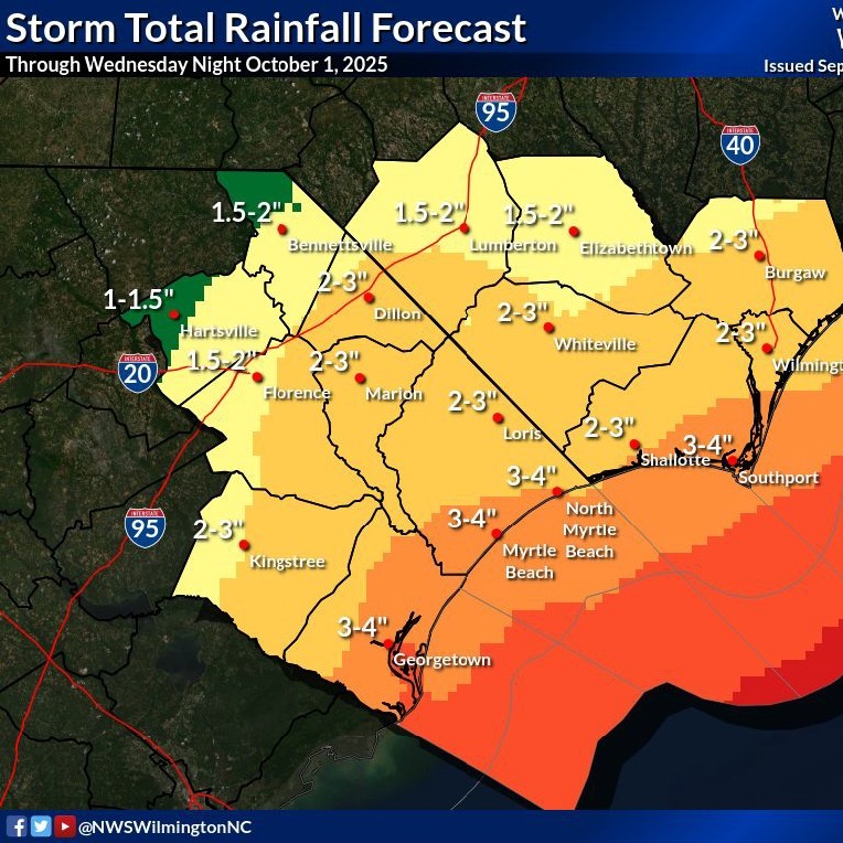
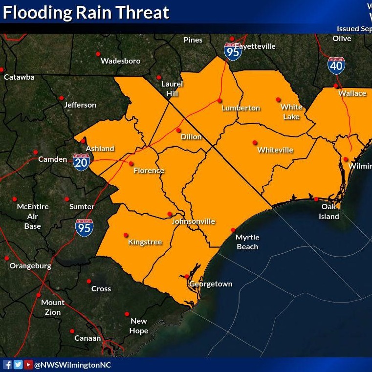
Rainfall:
- Florence County: 1–3 inches Monday through Tuesday
- Coastal areas: 2–4 inches, with isolated areas up to 6–8 inches
- Risk of flooding in low-lying and poor-drainage areas
- Flooding at night can be harder to recognize. Turn Around, Don’t Drown!
For Florence County:
Our main concern is periods of heavy rain Monday–Tuesday, which could lead to localized flooding. Conditions are expected to improve by Wednesday if the current forecast holds.
Preparedness Tips:
- Check your hurricane kit and restock supplies now
- Make sure you can receive emergency alerts on your phone or a weather radio
- Keep outdoor items secured or bring them in
- Avoid driving through flooded roads! Turn Around, Don’t Drown!
We will continue to watch this storm closely and provide updates as the forecast evolves.